Q’eswachaka Inca Rope Bridge and Four Lakes Tour from Cusco
Full Day
Up to 12 travelers
3,700 m / 12,139 ft
Easy to Moderate
Overview
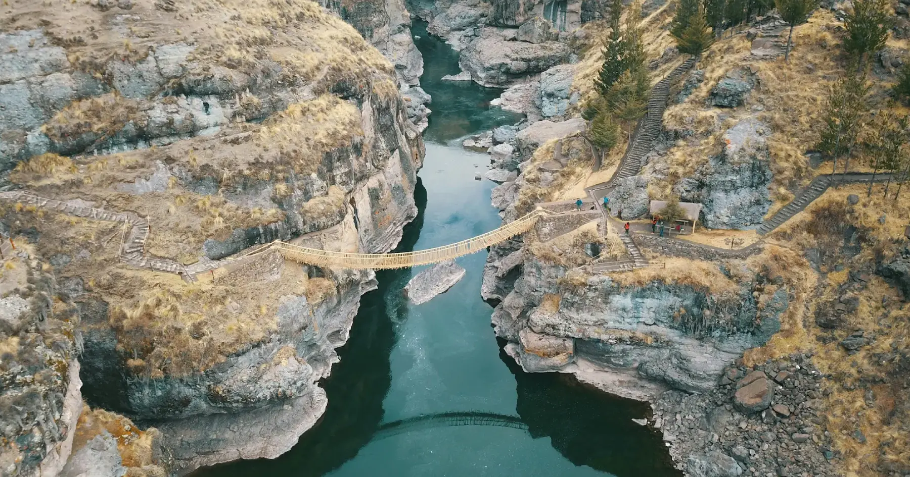
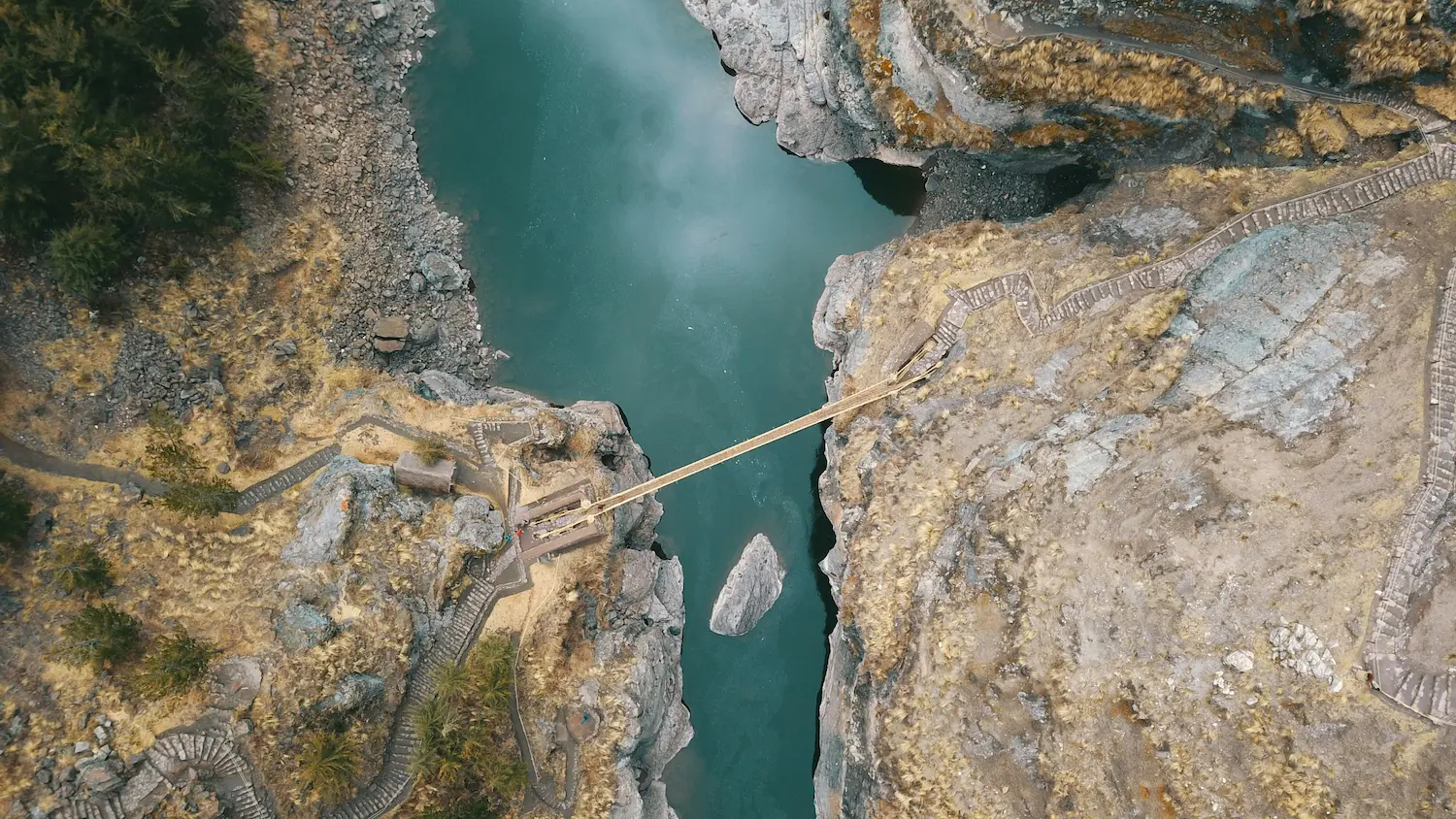
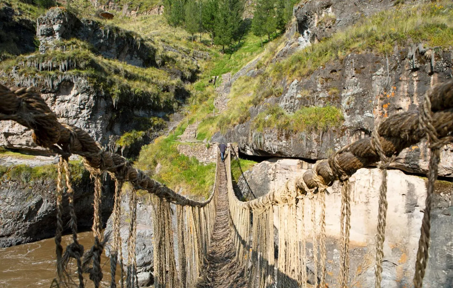
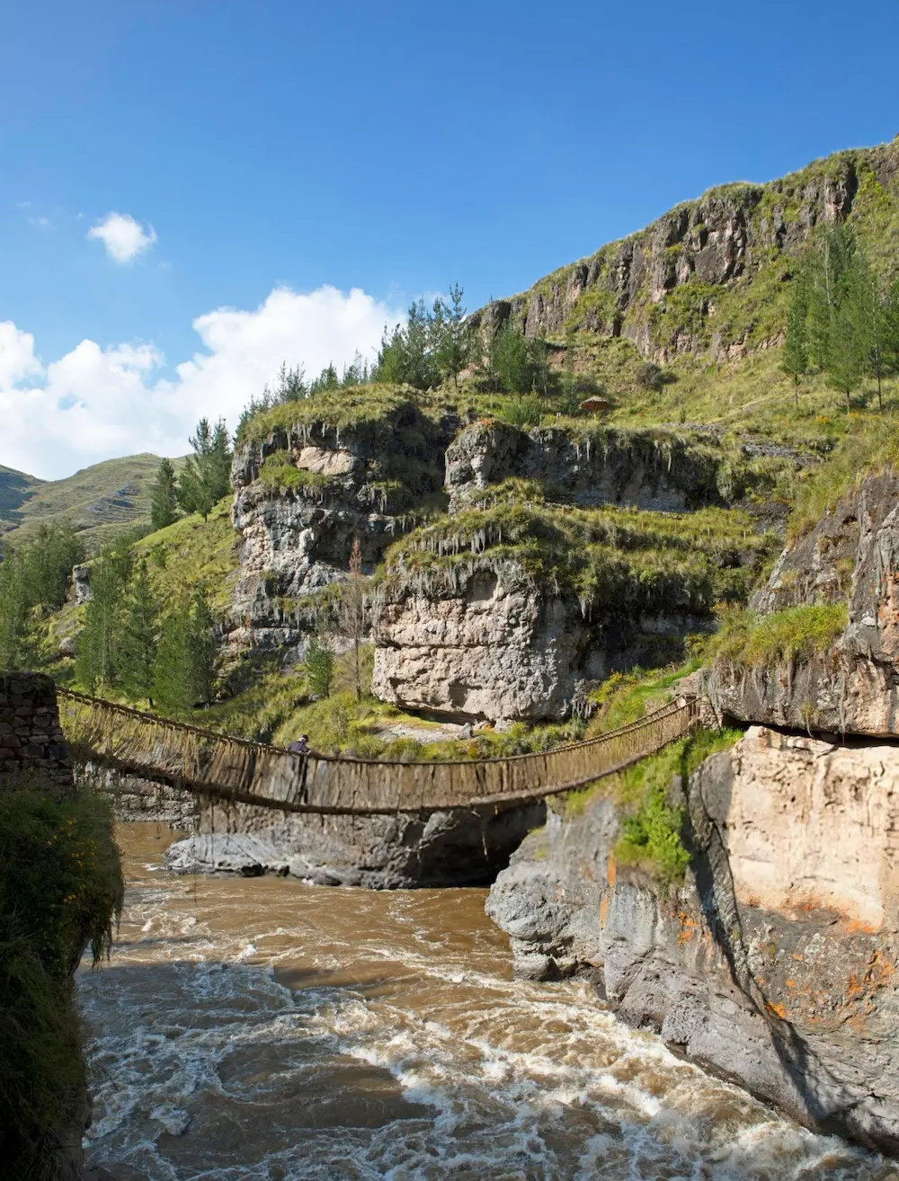
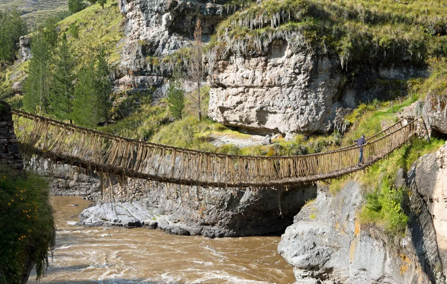
Q’eswachaka is a suspension bridge woven from grass over the Apurímac River, in the district of Quehue, Canas province. It is about 28 m (92 ft) long and 1.2 m (4 ft) wide, belongs to the Qhapaq Ñan, the Inca road network, and is described as the last Inca bridge still in use (La República, June 2026). This full-day tour crosses the highland lake circuit south of Cusco and the rural communities of Canas to reach the bridge and its canyon viewpoint.
Highlights of the route
- The Four Lakes: scenic stops along the circuit of high-Andean lakes, a less-visited side of the Cusco region.
- Canas communities: the drive continues through rural communities toward Quehue while your guide introduces local history and customs.
- Q’eswachaka: a guided visit to the bridge and the Apurímac canyon viewpoint. The communities of Huinchiri, Chaupibanda, Choccayhua and Ccollana Quehue renew it each year; UNESCO inscribed the knowledge, skills and rituals of this renewal on its list of Intangible Cultural Heritage of Humanity in 2013.
What's Included
Included 5
- Pre-tour coordination
- Professional bilingual guide
- Round-trip tourist transport
- First-aid kit and emergency oxygen
- Small-group assistance
Not Included 4
- Tourist entrance fees unless expressly stated
- Travel insurance
- Personal expenses and tips
- Services or activities not described in the itinerary
What Should You Bring? 7
- Passport or ID
- Water
- Sun protection
- Comfortable walking shoes
- Warm layers
- Rain jacket or poncho
- Small amount of cash
Itinerary
1
South Cusco route
Cusco – Four Lakes
Morning departure from Cusco heading south, with scenic stops along the circuit of high-Andean lakes.
2
Community landscape
Canas province – Quehue
The drive continues through the rural communities of Canas province toward the district of Quehue while the guide introduces local history and customs.
3
Q'eswachaka
Apurímac canyon – Q'eswachaka – Cusco
Guided visit to the Q'eswachaka bridge and the Apurímac canyon viewpoint, with time to learn how the communities rebuild it each June. Lunch stop and return drive to Cusco.
Good to know
A living bridge
According to UNESCO, families prepare thin ropes of twisted grass that bridge builders braid into six large cables and anchor to the old stone foundations; the renewal itself lasts only three days. It takes place every June (La República gives 11 to 14 June as the usual dates) and begins with offerings to Pachamama and the apus. Because the bridge is made of grass, its condition changes: in May 2025 it was damaged and the communities rebuilt it before reopening it to visitors in June (Andina).
Difficulty and altitude
The tour is rated easy to moderate, with a maximum altitude of about 3,700 m (12,139 ft). Much of the day is spent on the road; walking is limited to the stops along the route and the path to the bridge and viewpoint. See our guide to altitude sickness in Cusco if you have just arrived.
Who this tour is for
Travelers interested in living Andean culture, Inca engineering and rural landscapes, who are happy to spend a long day on the road in exchange for a place few visitors reach.
Best time to go
The dry season, roughly May to October, has the most stable weather in the Cusco highlands (Andina). June is the month of the renewal.
What to bring
Passport or ID, water, sun protection, comfortable walking shoes, warm layers, a rain jacket or poncho and some cash for entrances and personal expenses.
Good to know
- Groups are limited to 12 travelers.
- Weather, road conditions, community access and site schedules may require the guide to change the order of the day without removing the main experience.
- Travel insurance, personal expenses and tips are not included.
Frequently Asked Questions
Where is the Q'eswachaka bridge?
Over the Apurímac River in the district of Quehue, Canas province, in the Cusco region. The tour reaches it through the highland lake circuit south of Cusco.
Why is Q'eswachaka rebuilt every year?
The bridge is made of grass ropes that wear out, so the communities of Huinchiri, Chaupibanda, Choccayhua and Ccollana Quehue replace it each June in a three-day collective effort (UNESCO). The knowledge, skills and rituals of this renewal have been Intangible Cultural Heritage of Humanity since 2013.
How big is the bridge?
About 28 m (92 ft) long and 1.2 m (4 ft) wide, according to La República (June 2026). It is part of the Qhapaq Ñan, the Inca road network.
When does the renewal take place?
Every June. La República gives 11 to 14 June as the usual dates, and UNESCO notes that the work itself lasts three days. Exact dates are set by the communities each year.
How difficult is the tour?
Easy to moderate. The maximum altitude is about 3,700 m (12,139 ft) and most of the day is spent on the road, with short walks at the stops and to the bridge viewpoint.
Do I need to acclimatize first?
The route is manageable for most travelers, but a relaxed first day in Cusco is helpful if you have just arrived at altitude. Our altitude sickness guide has more advice.
How does it compare with the Waqrapukara tour?
Both head to the provinces south of Cusco. Q'eswachaka is a cultural day with little walking and a maximum altitude of about 3,700 m. The Waqrapukara tour is a 13.8 km hike reaching 4,580 m to an archaeological site above the same Apurímac canyon.
Can the itinerary change?
Yes. Weather, road conditions, community access and attraction schedules may require the guide to adjust the order without removing the main experience.