Quelccaya Glacier Tour from Cusco: Day Trip to the Vilcanota Ice Cap
Full Day
Up to 8 travelers
5,200 m / 17,060 ft
Challenging
Overview
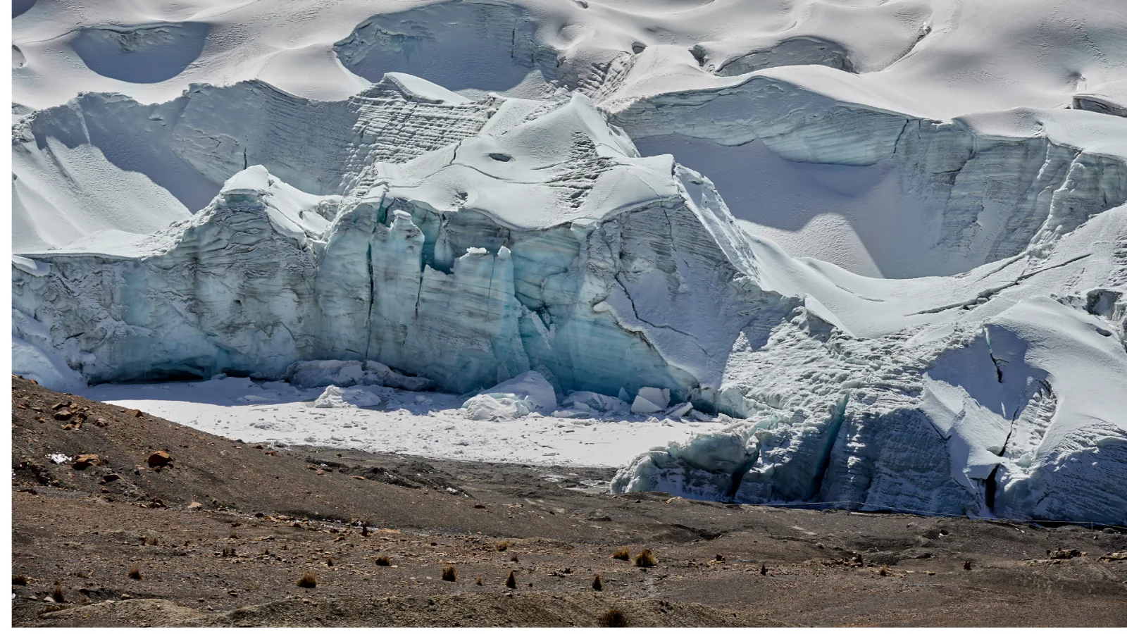
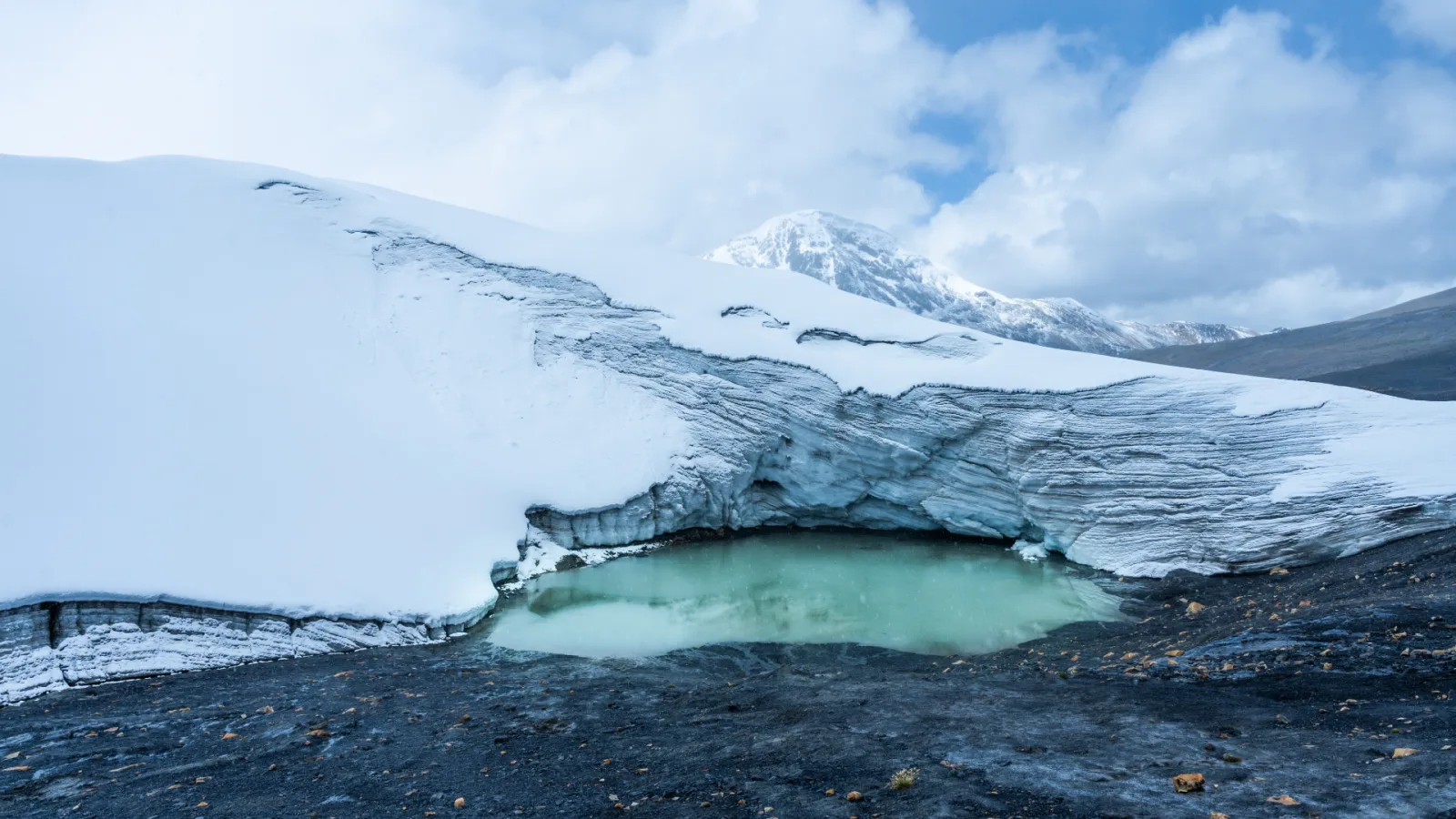
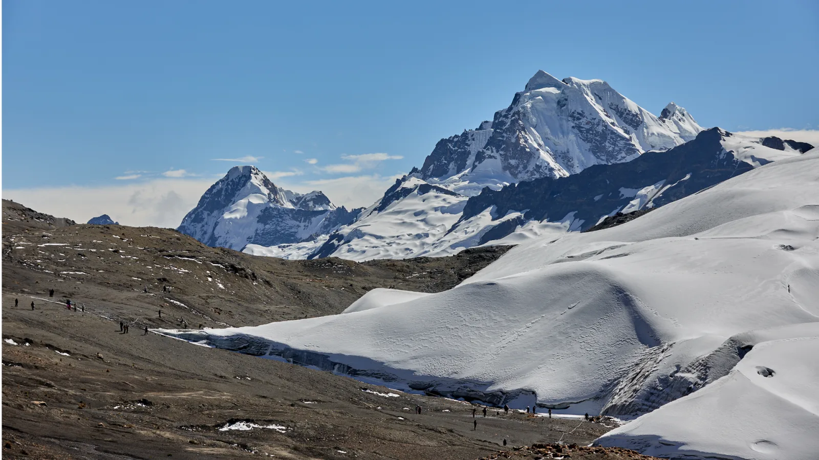
Quelccaya is an ice cap in the Cordillera Vilcanota, between the Cusco and Puno regions, described by Peru’s Congress as one of the largest tropical glacier masses in the world. It is also one of the clearest signs of climate change in the Andes: comparing NASA satellite images, its area fell from about 58 km² in 1988 to just over 40 km² in 2023 (Actualidad Ambiental, December 2023). This full-day tour is an expedition-style day: a long drive through remote highland communities and a short but very high walk to a safe viewpoint at the edge of the ice.
Highlights of the route
- The Vilcanota highlands: a long drive through remote communities of the Cusco high country toward the glacier region.
- The moraine: a rocky climb over ground left behind by the retreating ice.
- The ice edge: a viewpoint facing the glacier, where your guide explains how and why it is shrinking. In 2024, Law 32131 declared the creation of a Quelccaya Glacier Geopark to be of national interest (Congress of Peru).
What's Included
Included 6
- Pre-tour coordination
- Professional bilingual guide
- Round-trip tourist transport
- First-aid kit and emergency oxygen
- Small-group assistance
- Breakfast and lunch (packed lunch)
Not Included 4
- Tourist entrance fees unless expressly stated
- Travel insurance
- Personal expenses and tips
- Services or activities not described in the itinerary
What Should You Bring? 7
- Passport or ID
- Water
- Sun protection
- Comfortable walking shoes
- Warm layers
- Rain jacket or poncho
- Small amount of cash
Itinerary
1
Expedition departure
Cusco – Vilcanota highlands
Very early pickup in Cusco and a long drive through remote highland communities toward the glacier region, to the vehicle stop north of the ice cap at 5,060 m (16,601 ft).
2
Guided approach
Quelccaya surroundings
High-altitude walk up the rocky moraine (5,150 m at 0.3 km) to a safe viewpoint at the ice edge at 5,260 m (17,257 ft), 0.8 km from the trailhead. The guide chooses the exact viewpoint according to weather and ground conditions; the route does not go onto the ice.
3
Return journey
Quelccaya – Cusco
Descent to the vehicle (1.6 km round trip), packed lunch and the long drive back to Cusco.
Route & elevation profile
- 1.6 kmhiking distance (1 mi)
- 5,260 mhighest point on foot: Glacier viewpoint (17,257 ft)
- +200 melevation gain from Glacier trailhead
- km 0 Glacier trailhead Vehicle stop north of the ice cap
- km 0.3 Moraine Rocky moraine climb
- km 0.8 Glacier viewpoint Safe viewpoint at the ice edge
- km 1.6 Glacier trailhead Return to the vehicle
Good to know
Difficulty and altitude
The tour is rated challenging because of the altitude, not the distance. Our route profile starts at the trailhead at 5,060 m (16,601 ft), climbs the moraine to 5,150 m (16,896 ft) at 0.3 km and reaches the glacier viewpoint at 5,260 m (17,257 ft) at 0.8 km. The round trip is 1.6 km (1 mi) with about 200 m (656 ft) of climbing. That makes this viewpoint higher than the summit viewpoint of Rainbow Mountain (5,036 m). The route stays at authorized viewpoints and does not go onto the ice, and the exact walking distance is decided on site according to weather and ground conditions.
Who this tour is for
Well-acclimatized travelers in good health who want to see a tropical glacier up close and understand its retreat. Spend at least two nights in Cusco first and read our guide to altitude sickness in Cusco; if you have heart or lung conditions, check with your doctor before booking.
Best time to go
The dry season, roughly May to October, brings the most stable weather in the Cusco highlands (Andina). It is cold at this altitude in any month, and conditions at the ice can change quickly.
What to bring
Passport or ID, water, sun protection (the sun is strong near the ice), comfortable walking shoes, warm layers including hat and gloves, a rain jacket or poncho and some cash for personal expenses.
Good to know
- Breakfast and lunch are included; lunch is a packed meal.
- Groups are limited to 8 travelers.
- Weather, road conditions and community access may require the guide to adjust the plan without removing the main experience.
- Travel insurance, personal expenses and tips are not included.
Frequently Asked Questions
Where is the Quelccaya glacier?
In the Cordillera Vilcanota, between the Cusco and Puno regions of southern Peru. Peru’s Congress describes it as one of the largest tropical glacier masses in the world.
How high does the walk go?
Our route profile starts at 5,060 m (16,601 ft) and reaches the glacier viewpoint at 5,260 m (17,257 ft). That is higher than the 5,036 m (16,522 ft) summit viewpoint of Rainbow Mountain.
How long and how hard is the walk?
Short but hard: 1.6 km (1 mi) round trip with about 200 m (656 ft) of climbing over a rocky moraine. The difficulty comes from the altitude, so walk slowly and stop whenever you need to.
Do I walk on the glacier?
No. The route approaches authorized viewpoints at the ice edge without going onto unstable ice. The exact walking distance is decided on site according to weather and ground conditions.
Do I need to acclimatize first?
Yes. Spend at least two nights in Cusco before this tour and avoid strenuous activity if you feel symptoms of altitude sickness. See our altitude sickness guide.
How fast is Quelccaya retreating?
Comparing NASA satellite images, its area fell from about 58 km² in 1988 to just over 40 km² in 2023, according to Actualidad Ambiental (December 2023). Your guide explains the visible signs of this retreat at the viewpoint.
How does it compare with Rainbow Mountain?
The Rainbow Mountain tour is a 7.4 km round-trip hike to 5,036 m. Quelccaya has a much shorter walk (1.6 km) but reaches a higher point, 5,260 m, and involves a longer drive to a remote area.
What should I bring?
Passport or ID, water, strong sun protection, comfortable walking shoes, warm layers with hat and gloves, a rain jacket and some cash for personal expenses. Breakfast and a packed lunch are included.