In this article
- Quick answer
- Vinicunca at a glance
- Why does it have colors?
- A mountain that became famous recently
- How to get there: the two accesses
- The Red Valley
- Access in 2026: a dispute between communities
- Conservation and the mining concession
- Weather and best time
- Altitude and safety
- On foot, by ATV or another mountain?
- Frequently asked questions
- Sources
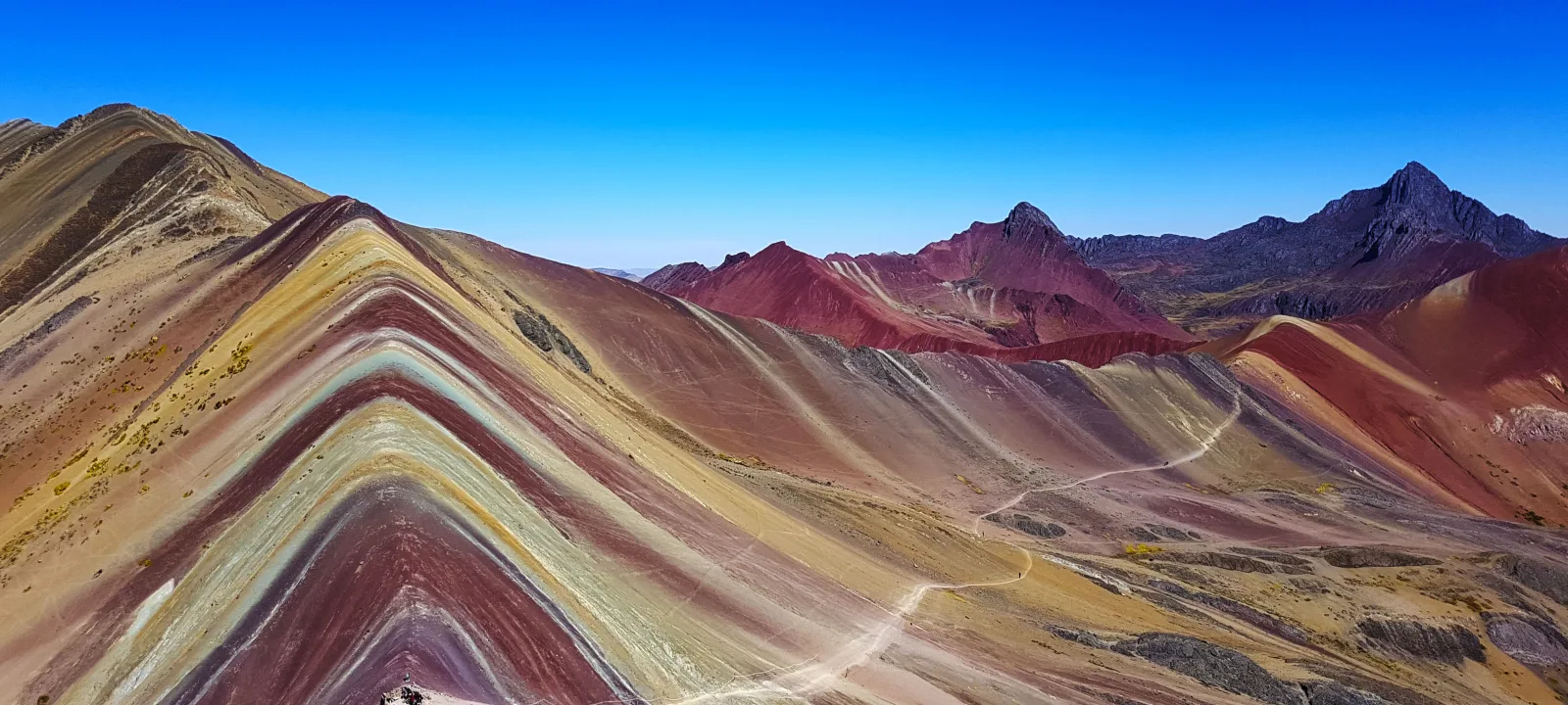
Rainbow Mountain, or Vinicunca (Winikunka, the “Mountain of Seven Colors”), is a mountain with red, pink, green and ochre stripes in the Andes of Cusco, with its viewpoint at 5,036 m. It lies between the districts of Cusipata and Pitumarca, about three hours from Cusco, and you reach it on foot or partly by ATV. This guide explains why it has colors, how to get there from each side, tickets, weather, safety and what is happening with access in 2026. Data checked on 10 November 2026.
Sources: MINCETUR’s tourism inventory (Vinicunca records updated in June 2026), PromPerú, the Cusco regional tourism office (Gercetur), Peru’s Presidency of the Council of Ministers (PCM), the Ministry of the Environment, Andina, Gestión, RPP and academic studies of the Vinicunca trails.
Quick answer
- Where: in the provinces of Quispicanchi (Cusipata) and Canchis (Pitumarca), a little over 100 km south-east of Cusco, according to Andina.
- Altitude: the viewpoint is at 5,036 m (MINCETUR), about 1,600 m higher than Cusco.
- Entrance: S/ 30 for foreign visitors and S/ 15 for Peruvians, according to MINCETUR. The local communities collect it; it is not on the Cusco Tourist Ticket.
- Hours: 6:00 to 17:00, all year.
- The hike: from Cusipata, 3 km uphill in 1 h 45 min; from Pitumarca, 2 km in about 25 minutes, or 10 minutes by ATV.
- Best time: the dry season, April to October. From November to April snow can cover the colors.
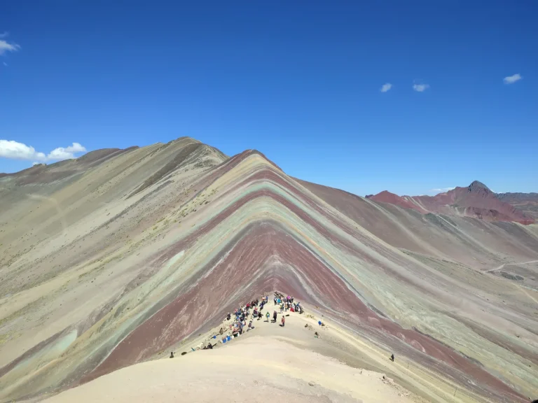 Rainbow Mountain on foot, with a guide
Rainbow Mountain Hike from Cusco: Full-Day Tour to Vinicunca
See itinerary & dates →
Vinicunca at a glance
| Fact | Figure | Source |
|---|---|---|
| Altitude of the viewpoint | 5,036 m (16,522 ft) | MINCETUR |
| From Cusco | A little over 100 km, about 3 hours | Andina |
| Entrance | S/ 30 foreigners · S/ 15 Peruvians | MINCETUR, June 2026 |
| Hours | 6:00–17:00, all year | MINCETUR |
| Temperature | From −5 °C at night to 13 °C by day | MINCETUR |
| Visitors in high season | Up to almost 1,500 a day | Gercetur Cusco, via Andina (February 2026) |
| Open to tourism | Since 2015–2016 | Municipality of Pitumarca and MINCETUR |
Why does it have colors?
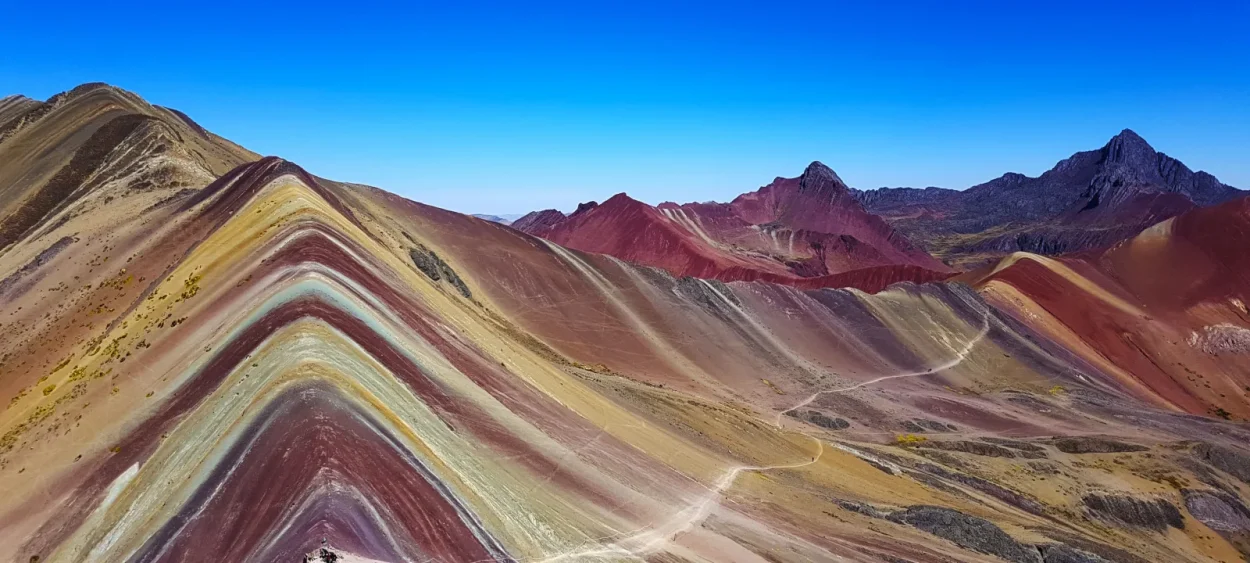
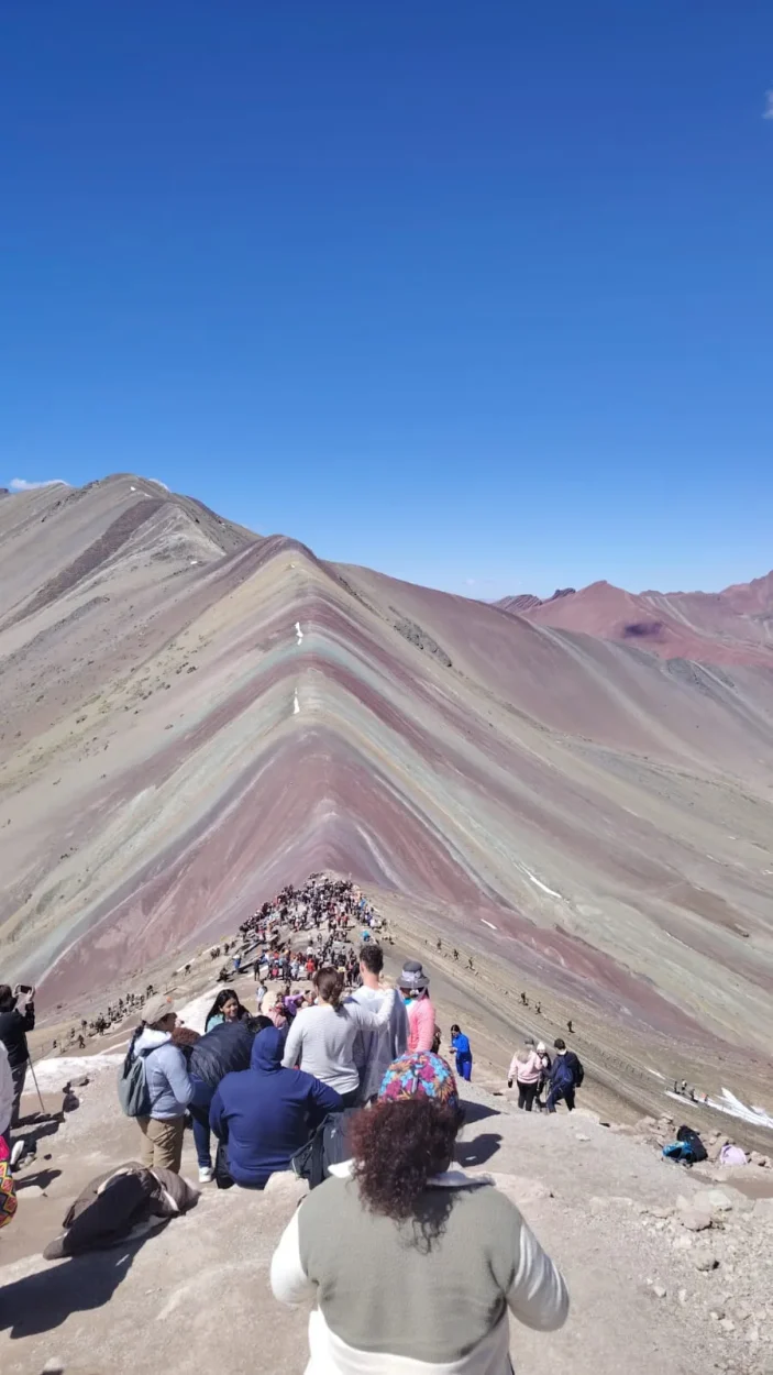
MINCETUR explains the color pattern by the oxidation of minerals and tectonic processes: marine, lake and river sediments that were laid down in layers and then lifted by the folding of the Andes. Each color corresponds to a material, according to the official record:
- Pink: red clay, mudstones and sandy clay.
- Whitish: quartz sandstone and marls, rich in calcium carbonate.
- Red: claystones with iron and clays from the Upper Tertiary.
- Green: phyllites and clays rich in ferromagnesian minerals.
- Earthy brown: fanglomerate with magnesium-rich rock, from the Quaternary.
- Mustard yellow: calcareous sandstones rich in sulfide minerals.
The geologist César Muñoz, of the Geological Society of Peru, told BBC Mundo that these sediments date from about 65 to 2 million years ago and that the colors appear through oxidation caused by moisture and through erosion. INGEMMET, Peru’s geological survey, lists Vinicunca among the geosites of the proposed Quelccaya Geopark.
A mountain that became famous recently
According to PromPerú, the mountain lay under glaciers and snowfall that began to recede in the early 1990s, although the experts quoted in the press do not agree on how much ice it had. It was discovered for tourism by trekkers on their way to Mount Ausangate, and social media did the rest. The mayor of Pitumarca dated the start of the boom to November 2015, and MINCETUR records that the community of Pampachiri has run the Pitumarca side since 2015, and the community of Chillihuani with the Municipality of Cusipata the Cusipata side since 2018.
In December 2018 Andina already called it Peru’s second most visited tourist destination, with more than half a million visitors that year according to the regional governor. Today, in high season, up to almost 1,500 visitors arrive a day, according to the regional tourism office. The people of Chillihuani and Llaqto know it as “cerro colorado” and consider it a sacred natural place, MINCETUR notes.
How to get there: the two accesses
| Stretch | Cusipata side | Pitumarca side |
|---|---|---|
| Paved road | Urcos → Paucarpata turn-off: 34.1 km, 38 min | Sicuani → Pitumarca: 51.9 km, 1 h 10 min |
| Dirt road | Turn-off → Chillihuani (Llaqto sector): 25 km, 1 h | Pitumarca → Cayllahuire sector: 19 km, 1 h 20 min |
| Hike to the viewpoint | 3 km, 1 h 45 min uphill | 2 km, 25 min, or 2.5 km by ATV (10 min) |
| Run by | Chillihuani community and Municipality of Cusipata | Pampachiri community |
Distances and times: MINCETUR records (June 2026). From Cusco it is a little over 100 km and about three hours by bus or car to the start of the hike, according to Andina. The Pitumarca record places its viewpoint above 5,200 m. Both communities rent out horses for the climb.
Our hiking route, from Cusipata
On our hiking tour we start at Phulawasipata (Cusipata side), at 4,620 m. It is 3.7 km to the viewpoint and 7.4 km round trip, with about 416 m of ascent, half of it in the last kilometer. The whole route is above 4,600 m, so you walk slowly and with stops.
The Red Valley
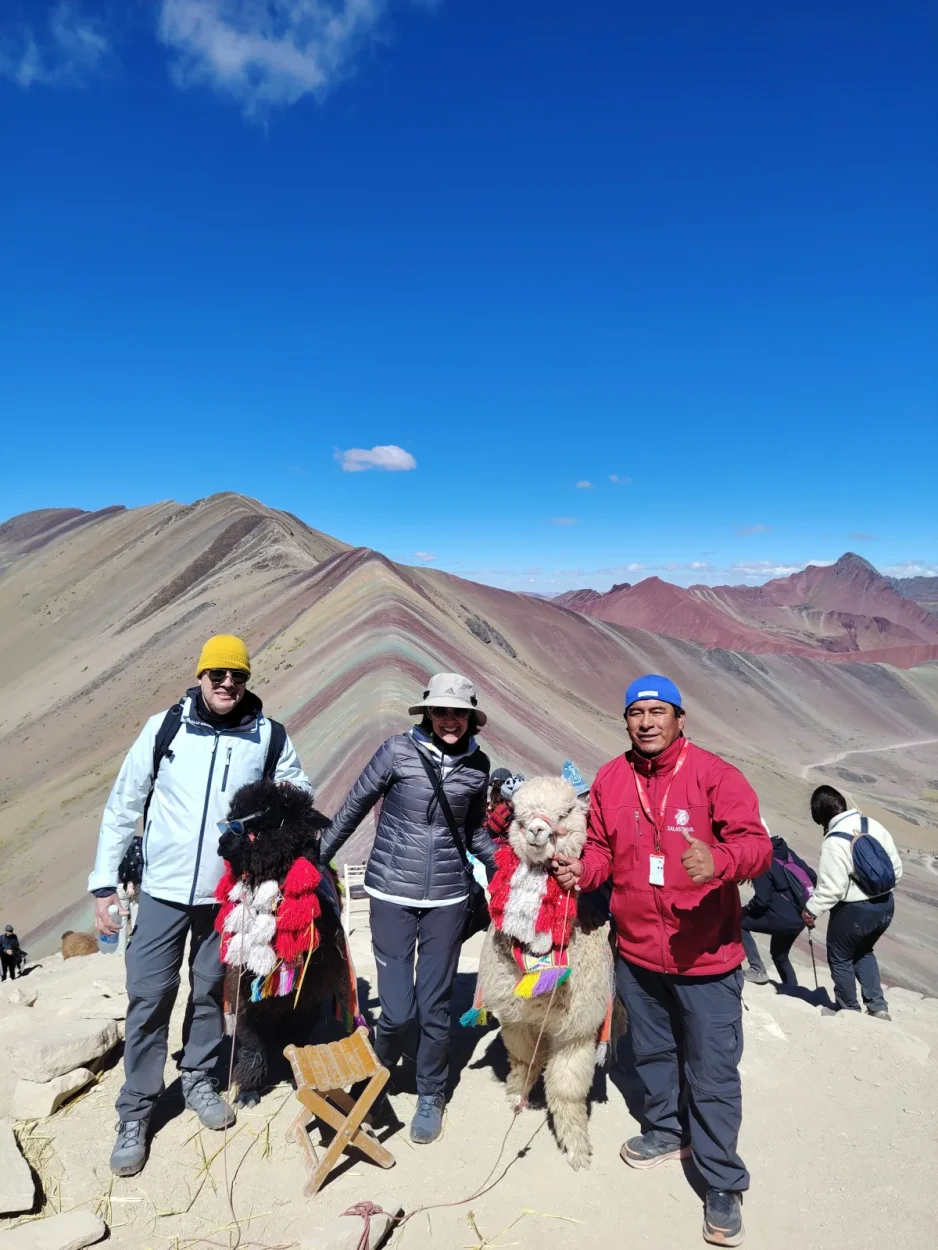
Next to the mountain, the red slopes of the Red Valley can be seen from the ridge of the viewpoint, and some routes continue on foot to it. Our ATV tour with the Red Valley includes it. It is as exposed as the summit: in November 2024 a tourist was killed by lightning on the Red Valley mountain, RPP reported.
Access in 2026: a dispute between communities
Managing the entrance on the Cusipata side has set the Chillihuani community against the Llaqto sector for years, and access has been closed several times:
- 2018: a clash between communities left dozens injured, according to Actualidad Ambiental.
- November 2023: the Municipality of Cusipata suspended the Cusipata–Chillihuani route because of the confrontation, Andina reported.
- July 2024: after a truce, the mountain reopened with free entry, Andina reported.
- August 2024: a new clash left one dead and four injured, according to Gestión.
- March 2026: the communities agreed to set up a Transitional Tourism Committee.
- June 2026: at a meeting convened by the PCM, Chillihuani and Llaqto agreed that a commission would temporarily collect the entrance fees until the Committee is registered with the Public Registry.
We have found no official news after June 2026. We confirm the access route before every departure.
Conservation and the mining concession
- The 2018 concession: in March 2018 INGEMMET granted Minquest Perú, owned by the Canadian company Camino Minerals, the “Red beds 2” concession of 400 hectares between Cusipata and Pitumarca, which included the mountain, according to RPP. After public outcry, the company gave it up in a letter dated 21 May 2018 (Andina) and the permit was annulled (Mongabay).
- Ausangate Regional Conservation Area: the Ministry of the Environment created it in December 2019 (Supreme Decree 012-2019-MINAM), in the districts of Ocongate, Pitumarca and Checacupe. Vinicunca’s lands were taken out of the proposal because the communities opposed it, according to Actualidad Ambiental, so the mountain is not inside it.
- Local protection: the Municipality of Pitumarca declared it an area of public interest and protection in May 2016 (Ordinance 0016-2016-MDP).
- Trail erosion: researchers from Adam Mickiewicz University (Poland) who studied Vinicunca recorded widening and deepening trails, braided parallel paths and muddy sections; the horse path reaches 17 m in width. Always stay on the marked trail.
Weather and best time
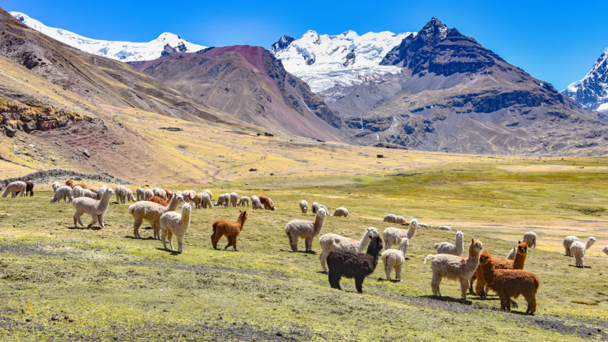
MINCETUR gives temperatures from −5 °C at night to 13 °C by day and recommends the dry season, April to October. From November to April, the rainy season, snow can cover the stripes, according to Andina. In February 2026 the mountain was completely covered in snow, some bridges fell and the regional risk office recommended considering closing access. As early as 2018 the regional tourism authority asked operators not to sell visits during snowfall.
Altitude and safety
- Acclimatize: the viewpoint is about 1,600 m above Cusco. Spend at least two or three days in Cusco before climbing and read our guide to altitude sickness in Cusco.
- See your doctor if you have a heart or lung condition or are pregnant. In June 2018 a 70-year-old tourist died after reaching the summit, Andina reported.
- Lightning: the regional tourism office warns of the risk of lightning, which has cost lives in previous years. In the rainy season, go down if a storm approaches.
- Dress warmly and protect yourself from the sun: layers, a rain jacket, hat, gloves, sunglasses and sunscreen.
On foot, by ATV or another mountain?
- On foot (Cusipata side): the full experience, for fit and acclimatized hikers.
- By ATV (Pitumarca side): you ride close to the viewpoint and walk the last stretch; see the ATV tour.
- Another rainbow mountain: Palccoyo is gentler and quieter, and Pallay Punchu the newest. Compare them in Rainbow Mountain vs Palccoyo vs Pallay Punchu.
- At sunrise, without crowds: the 4-day Ausangate Trek reaches the mountain early.
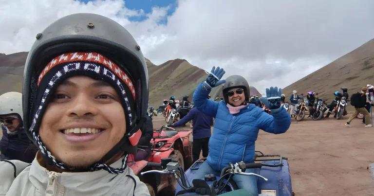 Rainbow Mountain by ATV
Rainbow Mountain ATV Tour from Cusco (Vinicunca)
See itinerary & dates →
Frequently asked questions
Where is Rainbow Mountain?
In Cusco, between the districts of Cusipata (Quispicanchi) and Pitumarca (Canchis), a little over 100 km south-east of the city of Cusco.
How high is Rainbow Mountain?
Its viewpoint is at 5,036 m (16,522 ft), according to MINCETUR: about 1,600 m higher than Cusco.
How much is the entrance to Rainbow Mountain?
S/ 30 for foreign visitors and S/ 15 for Peruvians, according to MINCETUR’s records of June 2026. The communities collect it and it can change.
How long is the hike?
From Cusipata, 3 km uphill in 1 h 45 min; from Pitumarca, 2 km in about 25 minutes, or most of it by ATV. Our route from Cusipata is 7.4 km round trip.
Why is the mountain colored?
Because of layers of sediments with different minerals, folded by tectonics and oxidized: red comes from claystones with iron, green from phyllites rich in ferromagnesian minerals and yellow from sandstones with sulfide minerals.
When is the best time to go?
The dry season, April to October. From November to April snow can cover the colors and there is a risk of thunderstorms.
Is Rainbow Mountain open?
It opens from 6:00 to 17:00 all year, but the Cusipata side has had closures because of disputes between communities and because of snowfall. Check access before you go; we do it before every departure.
Sources
- MINCETUR, tourism inventory: record 13101 (Cusipata side) and record 9278 (Pitumarca side), updated 12 June 2026 (altitude, minerals, accesses, entrance, hours, weather).
- PromPerú, Vinicunca, the beautiful mountain of seven colors (2026).
- Andina: the Vinicunca boom (2018), Peru’s second most visited destination (December 2018), where it is and how to get there (2025), closure considered for rain and snow (February 2026), suspension of visits (2023), reopening (2024), PCM agreement (June 2026), mining concession given up (2018) and the 2020 note on snow.
- Gestión: the August 2024 clash and Transitional Tourism Committee (March 2026); Actualidad Ambiental, Ausangate, the conservation area that could have been (2018) and the 2018 clash.
- RPP, the mining concession (2018) and lightning in the Red Valley (November 2024); Mongabay, the Ausangate conservation area and concessions (2019).
- Ministry of the Environment, Supreme Decree 012-2019-MINAM (Ausangate Regional Conservation Area).
- BBC Mundo, the geology of Vinicunca (2018); Tomczyk and Ewertowski, tourism impact on the Vinicunca trails, EGU 2024; INGEMMET and the Quelccaya Geopark (2025).
- INEI, Compendio Estadístico Cusco 2025 (altitude of Cusco); route profile: our hiking tour from Cusipata.