In this article
- Where is Choquequirao?
- Step 1: from Cusco to Cachora and Capuliyoc
- Getting to Cachora on your own by public transport
- Hiring a muleteer in Cachora
- Sayhuite: a stop near the Cachora turn-off
- Step 2: the trek to the ruins
- Other ways to reach Choquequirao
- Best time to visit Choquequirao
- Do you need a guide or a permit?
- How many days do you need?
- Frequently asked questions
Quick answer: Choquequirao can only be reached on foot. The usual route starts at Capuliyoc, above the village of Cachora, about 4 hours by road from Cusco. From there it takes two days to hike down into the Apurímac canyon and up to the ruins, and two more to come back. The best time to go is the dry season, from April to October.
Where is Choquequirao?
Choquequirao sits at 3,064 m (10,052 ft) on a mountain spur above the Apurímac river, in the Cusco region (province of La Convención). The Apurímac river below it marks the border with the Apurímac region. It is about 100 km west of Cusco in a straight line, but there is no road to the site: a deep canyon separates it from the nearest villages.
This explains why the trek starts in another region:
- Choquequirao: Cusco region, on the north side of the Apurímac canyon.
- Cachora and Capuliyoc: Apurímac region (province of Abancay), on the south side, facing the ruins: the main access.
- Huanipaca and Kiuñalla: also in the Apurímac region, on the same side of the canyon as Cachora, further west.
- Yanama: on the Cusco side, behind the site. It is used on the long trek to Machu Picchu.
Step 1: from Cusco to Cachora and Capuliyoc
The trek begins on the Apurímac side of the canyon:
- Cusco to the Cachora turn-off: about 3 hours on the highway to Abancay, passing Limatambo and the Apurímac bridge.
- Turn-off to Cachora: a smaller road climbs to the village of Cachora (about 2,900 m).
- Cachora to Capuliyoc: a dirt road continues to the Capuliyoc viewpoint (2,918 m), where the trail starts.
On our tour, a private vehicle picks you up at your hotel in Cusco and drives you to Capuliyoc in about 4 hours. Independent travelers usually take a bus from Cusco towards Abancay, get off at the Cachora junction and continue by taxi.
Getting to Cachora on your own by public transport
If you travel independently, this is the usual sequence:
- Bus from Cusco towards Abancay: buses towards Abancay leave Cusco every day, with departures in the morning. Tell the driver you are getting off at the Cachora turn-off, known locally as the Ramal de Cachora. The full trip to Abancay takes about 4 hours, and in 2025 the fare was around 30–40 soles; you get off before Abancay.
- The turn-off: it is at about km 154 of the highway from Cusco (km 42 counting from Abancay), a few kilometers past the Sayhuite archaeological site.
- Taxi or colectivo down to Cachora: shared cars and taxis cover the side road to the village in about 45 minutes.
- Night in Cachora: most hikers sleep in a simple guesthouse in the village and leave early the next morning for Capuliyoc, by car or on foot.
Hiring a muleteer in Cachora
Cachora is the place to hire a muleteer (arriero) and mules; it is much harder to find one once you are on the trail. In 2025 the usual rate was about 80–90 soles a day for a mule and muleteer, plus the muleteer’s food, and you also pay the days he needs to return, usually 2 to 3.
- Agree on the number of days, the weight per mule and the total price before you leave.
- Ask in your guesthouse or on the main square; some Spanish helps.
On our tour, mules for the equipment, a mule for 7 kg of your personal gear and an emergency horse are included.
Sayhuite: a stop near the Cachora turn-off
The archaeological site of Sayhuite (also written Saywite) stands next to the highway at km 45 counting from Abancay, in the district of Curahuasi, at more than 2,400 m. Its best-known piece is a carved monolith about 4 m in diameter and 2.5 m high, covered with figures carved in relief, including animals. It is an easy stop on the way to or from the trek.
Step 2: the trek to the ruins
From Capuliyoc the trail drops almost 1,400 m to Playa Rosalina, on the Apurímac river, and climbs more than 1,500 m on the other side to Marampata and Choquequirao. Most hikers split it into two days.
- 39 kmhiking distance (24.2 mi)
- 3,064 mhighest point: Choquequirao (10,052 ft)
- +2,882 melevation gain from Capuliyoc
- km 0 Capuliyoc Start · view over the Apurímac canyon
- km 7 Chiquisca
- km 9 Playa Rosalina Camp 1 · Apurímac river
- km 12 Santa Rosa
- km 15.5 Marampata First view of Choquequirao
- km 19.5 Choquequirao Camp 2 · guided visit on day 3
- km 29.5 Playa Rosalina (return) Cross the Apurímac again
- km 32 Chiquisca (return) Camp 3
- km 39 Capuliyoc (end) Transport back to Cusco
Mules carry the camping equipment and there are basic campsites along the way at Chiquisca, Playa Rosalina, Santa Rosa, Marampata and near the ruins. See the full route, difficulty and day-by-day itinerary in our Choquequirao trek guide.
Other ways to reach Choquequirao
- From Huanipaca (Apurímac): a less used route that starts further west, on the same side of the canyon as Cachora, through the Kiuñalla area. It is steep and has fewer services.
- From Machu Picchu: the long Choquequirao to Machu Picchu trek connects both sites in 7 to 9 days, crossing high passes via Yanama.
- By cable car: not yet. The project is still in the tender stage; read the Choquequirao cable car update.
Best time to visit Choquequirao
Dry season: April to October
The best months to visit. Trails are dry, skies are clearer and river crossings are easy. June to August is the coolest and most stable period, although the canyon floor is always hot in the middle of the day.
Rainy season: November to March
Expect frequent rain, muddy and slippery descents and possible landslides. The site can close temporarily after heavy rain: in 2026 it was closed from 1 February to late April (it reopened around 22–23 April), with maintenance work on the trail before reopening.
The 2026 closure in detail
The Ministry of Culture closed all accesses to the park on 1 February 2026 because of heavy rain, at first for 30 days. The closure was extended while the trail was repaired. A reopening was announced for 15 April, but it was delayed and the Cachora route reopened around 22–23 April. The route from the Cusco side (Santa Teresa) stayed closed for longer.
Tips for any month
- Start the big climbs early, before the sun reaches the slopes.
- Carry sun protection and enough water for the hot canyon floor.
- Bring warm layers: nights at the Choquequirao campsite are cool.
Do you need a guide or a permit?
Choquequirao has no daily permit quota like the Inca Trail. You only pay the entrance ticket at the control point, which is included in our tour. You can hike independently if you are experienced and carry all your equipment, but a guided trek includes transport, a cook, mules for the camping gear, an emergency horse and a guide who explains a site with almost no information panels.
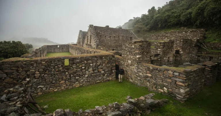 Transport, cook and mules included
Choquequirao Trek 4 Days / 3 Nights
See itinerary & dates →
Transport, cook and mules included
Choquequirao Trek 4 Days / 3 Nights
See itinerary & dates →
How many days do you need?
- 3 days: possible for very fit hikers, with little time at the ruins.
- 4 days: the recommended option, with a full guided visit of the site.
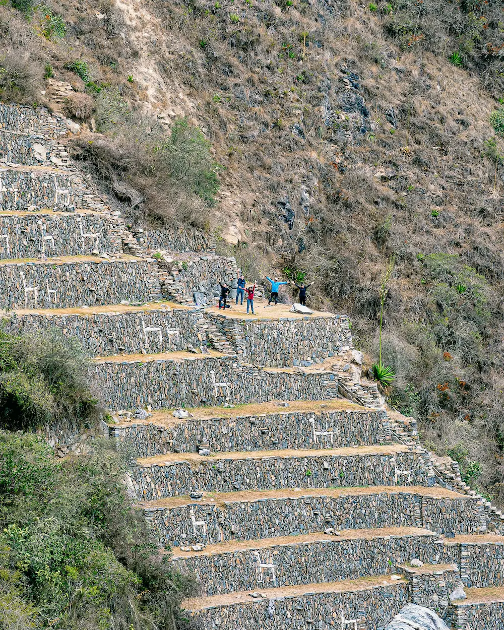
- 5 days: a relaxed pace, with extra time to explore the llama terraces.
- 7 to 9 days: Choquequirao to Machu Picchu.
Not sure whether to choose Choquequirao or the more famous site? Read Choquequirao vs Machu Picchu.
Frequently asked questions
How far is Choquequirao from Cusco?
About 4 hours by road from Cusco to the trailhead at Capuliyoc, plus two days of hiking to reach the ruins.
Can you drive to Choquequirao?
No. The road ends at Capuliyoc, on the other side of the canyon. From there you must walk.
What is the best month to visit Choquequirao?
May to September offer the most stable weather. April and October are also good, with fewer hikers.
Is Choquequirao closed in the rainy season?
It is not closed every year, but it can close temporarily after heavy rain, as happened from 1 February to late April 2026 (it reopened around 22–23 April). Check the status before you book a trip between January and April.
Can I get to Choquequirao by public transport?
Only as far as Cachora. Take a bus from Cusco towards Abancay, get off at the Cachora turn-off and continue by taxi or colectivo to the village. From Cachora and Capuliyoc you walk.
How much does the bus from Cusco cost?
In 2025 the fare from Cusco to Abancay was around 30–40 soles, and the trip takes about 4 hours. Prices change, so check at the terminal.
Do I need to hire a muleteer?
It is not required, but it helps a lot on such a steep trek. Hire one in Cachora; in 2025 the rate was about 80–90 soles a day, plus food and return days.
Is Choquequirao in Cusco or Apurímac?
In Cusco (province of La Convención). The usual access, through Cachora, is in the Apurímac region, on the opposite side of the canyon.
Can I start the trek from Huanipaca instead of Cachora?
Yes. Huanipaca and Kiuñalla are in Apurímac, on the same side as Cachora. The route is steeper and has fewer services, so most hikers use Cachora and Capuliyoc.